An Introduction to Google Earth as a Civil Engineering Tool

Google Earth has become a powerful tool in the construction field, and its applications are varied and far reaching. It is used for a variety of purposes, including planning, surveying, and visualizing construction projects. The implementation of Google Earth in the construction field has been growing in recent years, as its capabilities have become more advanced and its applications more accessible.
Define Google Earth
Google Earth is a virtual globe, map, and geographical information program created by Google. It allows users to explore the world in 3D, by zooming in and out of different locations. It can be used to view satellite images of different landscapes and landmarks, to observe the streets of different cities, to plan routes for getting to a destination, and more.
Additionally, it offers a variety of tools for viewing and manipulating geographical data, such as the ability to measure distances, search for specific locations, and view historical maps. Google Earth is available for desktop computers, mobile devices, and virtual reality headsets.
Google Earth Features
Google Earth also provides a range of useful tools for measuring distances and angles, as well as for creating maps. The software also allows users to measure the height of buildings and other structures, as well as the depth of the terrain. This can be used to assist in engineering and construction projects, as well as for monitoring construction projects.
Google Earth also offers a range of other features that are relevant to the construction field. It can be used to search for land parcels that are available for construction, as well as to search for roads and pathways that are suitable for construction. It can also be used to search for nearby infrastructure, such as power lines and water lines that could affect a construction project.
Implementation of Google Earth in Construction Field
The implementation of Google Earth in the construction field is an increasingly popular practice, as it offers a range of features that are particularly useful for the industry. Its use is becoming more widespread, as its capabilities are becoming more advanced and its applications are becoming more accessible. In the future, it is likely that Google Earth will become an even more important tool in the construction field, as its capabilities continue to expand.
Each project can save time and energy by using Google Earth to obtain such data easily. In addition to civil 3D, Midas, Revit, AutoCAD, and other civil engineering software, Google Earth is also very important to civil engineers. Construction sites can be geo profiled and their environmental conditions can be obtained using Google Earth software.
Most infrastructure projects use Google Earth, such as bridges, roads, highways, railways, culverts, canal alignments, water distribution systems, gardening, and irrigation systems.
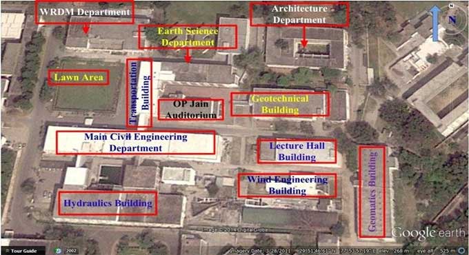
In the absence of visualization, initial site planning becomes very difficult. The use of Google Earth enables a better visualization of construction sites by providing the latest construction site data and real world surrounding environment. As a result, Google Earth is a great tool for site planning, project planning, and resource planning.
Merits of Google Earth in Civil Engineering
A construction site can be located in Google Earth along with surrounding structures and the environment, and distances between locations can be measured using Google Earth. The perimeter of a particular site and the area of a construction site can be measured with it. This equation allows you to obtain the elevation of any object in relation to mean sea level.
Any object can be located using Google Earth's longitude and latitude coordinates. Initial site planning is done using Google Earth in construction works. This method is used to determine the area of earthworks. A map aligns roads, highways, railways, canals, and bridges using it.
In order to find out the exact location of a Kamz file, it is used to open it. The purpose of it is to gather data for surveys. For elevation and section purposes, it is used to obtain site levels. 3D maps provided by Google Earth are helpful for visualizing sites.
To learn more, watch the following video tutorial.
Video Source: Surveying Engineering Design Information
Wrapping it Up
Google Earth offers a range of features that are particularly useful in the construction field. It allows users to view aerial images of construction sites, which can be used to plan and survey the area.
It also offers 3D models of buildings and other structures, which can be viewed from a variety of angles. This is particularly useful for visualizing construction projects and providing more detailed information about a site.
Obtaining perfect data on the construction site as well as latest landscape maps with proper details, such as buildings, roads, villages, trees, rivers, lakes, mountains, etc. is difficult in every construction project.